Arabesque
Arabesque ! and flow mapping becomes a breeze.
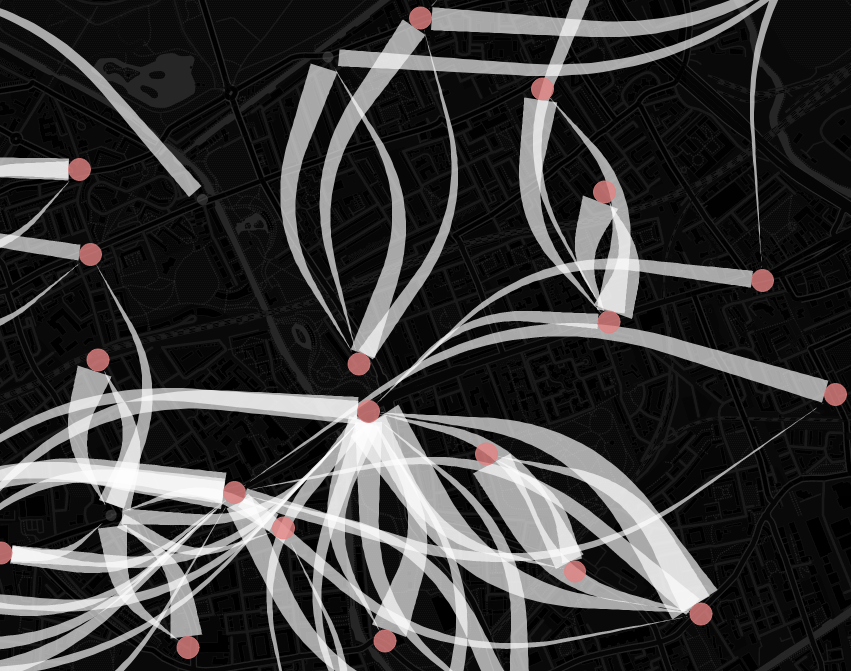
Arabesque is a web application for thematic mapping of flow and networks datasets
Begin new Map
Load Saved Map
![]() More Informations Below
More Informations Below![]()
Arabesques provides a web vizualisation tool to create flow map et explore it.
Built in javascript and HTML 5
To find the online tutorial of the application, click here (Temporaire)
Import
Load your flow data and nodes data to visualise it. It can be CSV, JSON or GEOJSON
If you do not have a node, preload files are provided following international codes (ISO3, INSEE, NUTS ...)
Draw
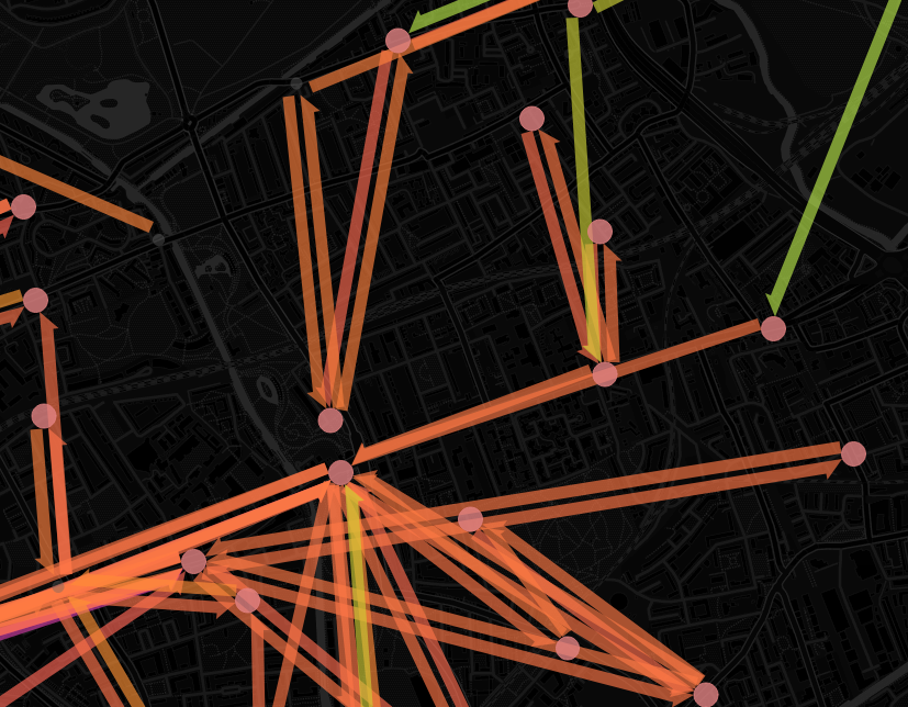
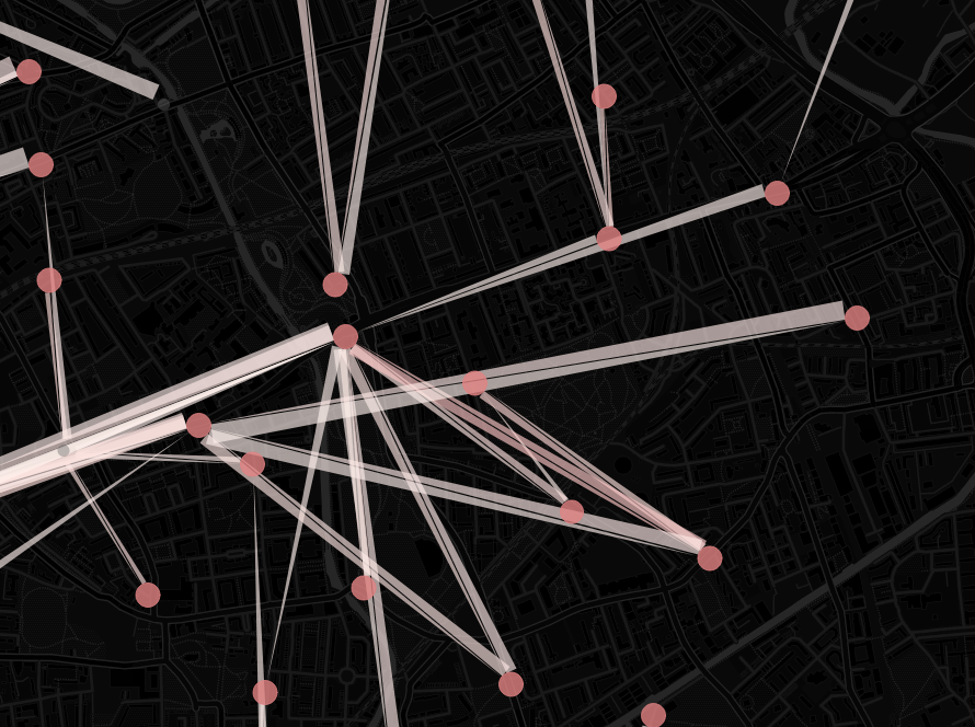
Choose the style that you want to create an unique flow map. Merge data and drawing to make flows more understable.
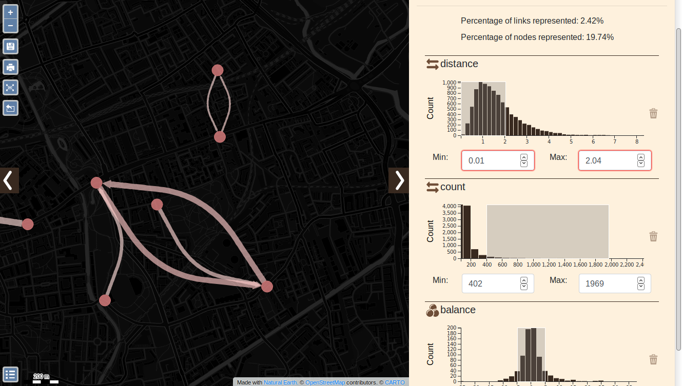
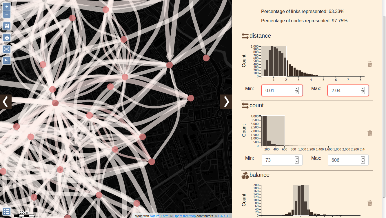
Explore
Save the map as a zip file for a future exploration !
Or export it as a png to add it to presentation !
Export
Save the map as a zip file for a future exploration !
Or export it as a png to add it to presentation !
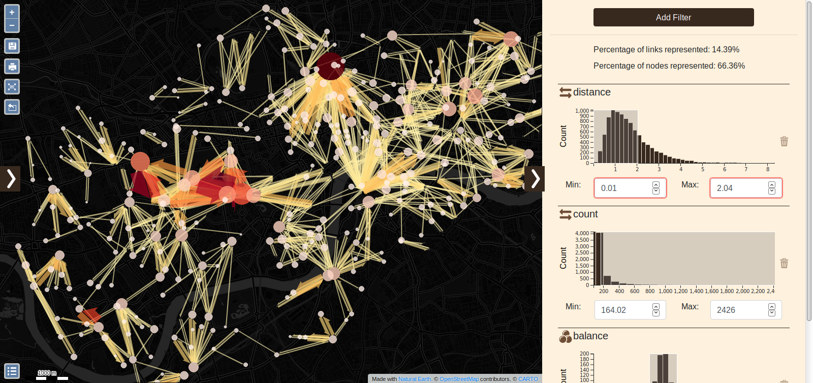
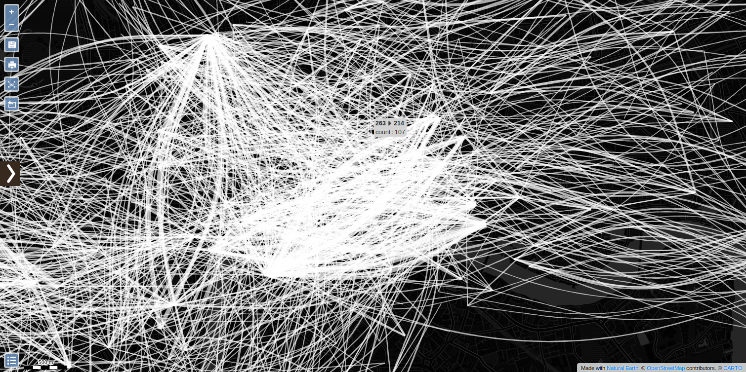
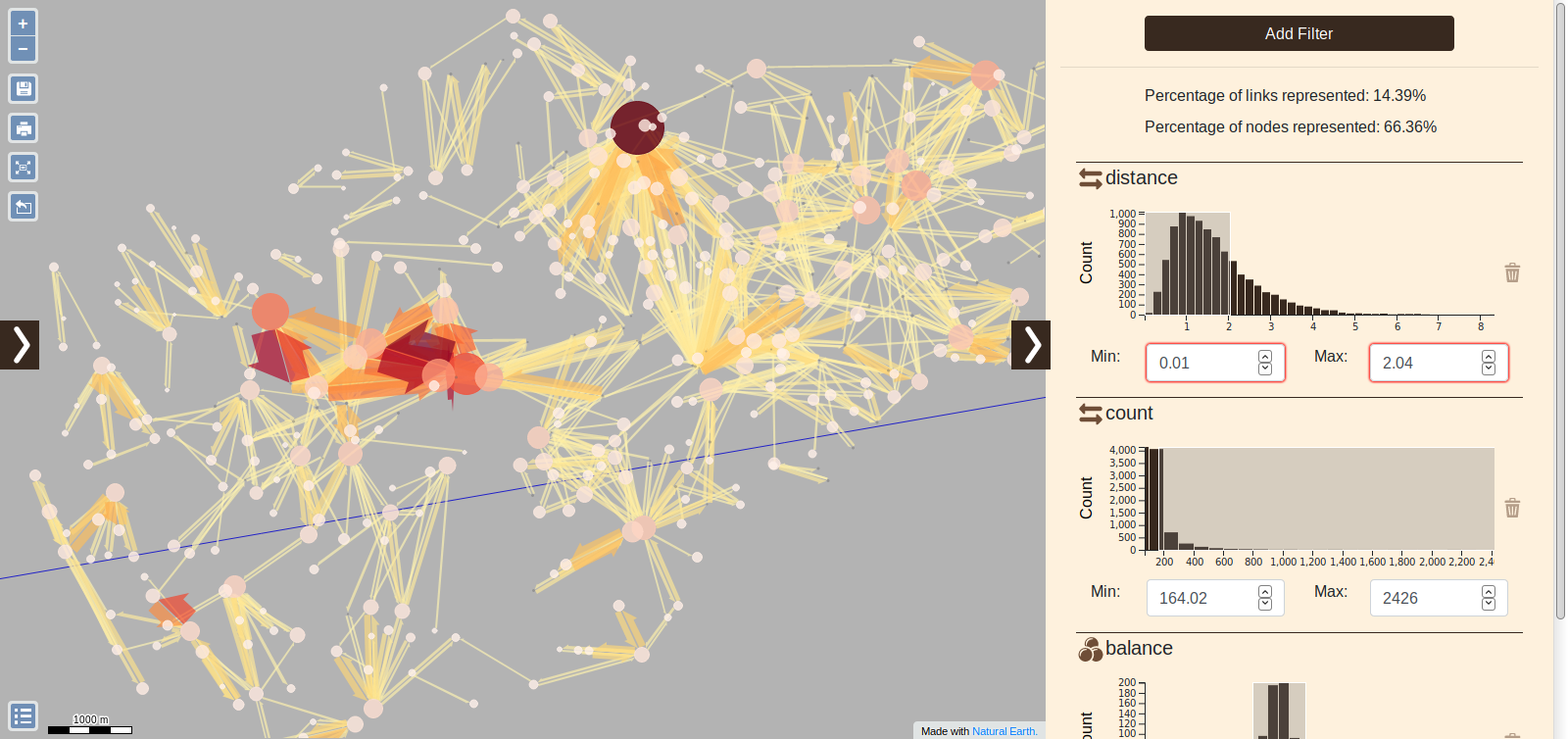
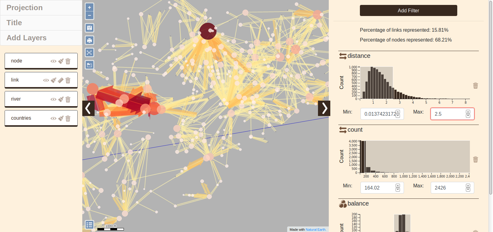
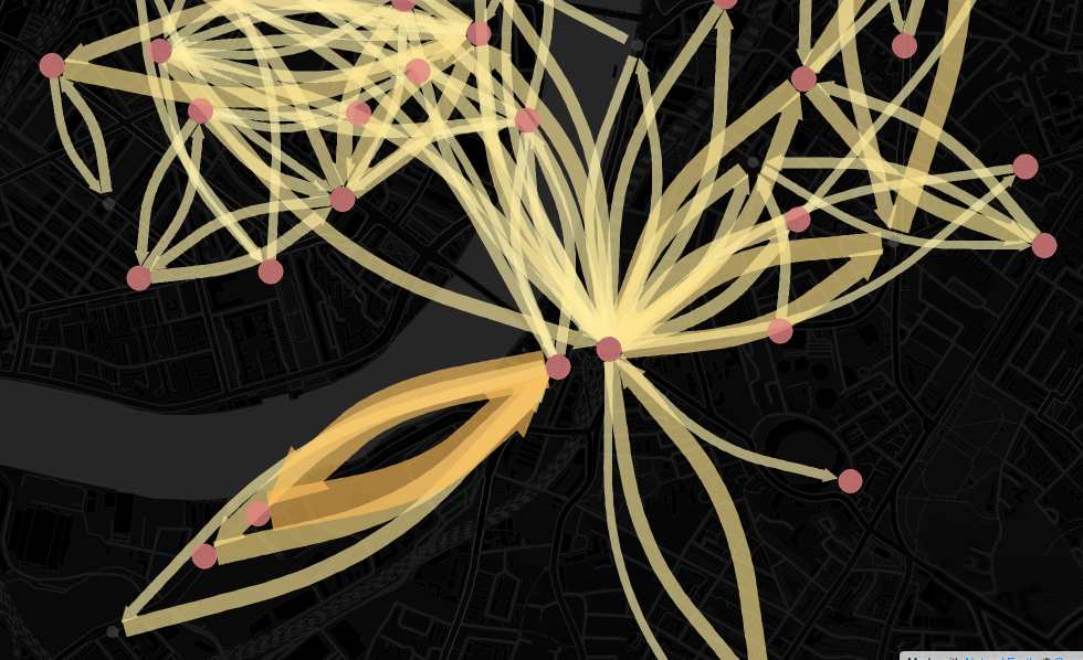
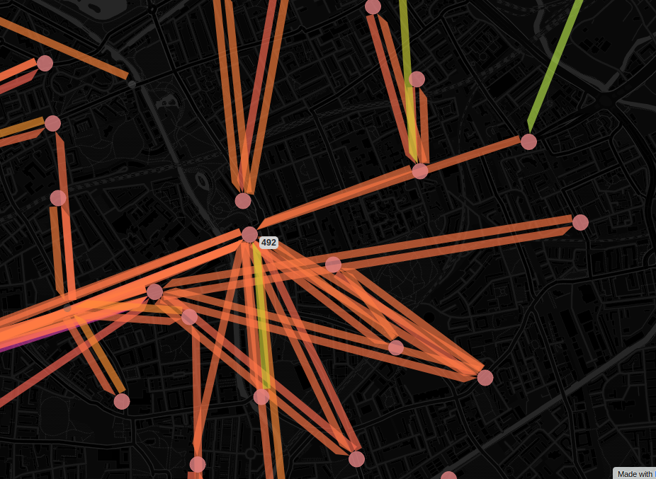
London Bike Traffic
This map is the flow of bicycle in the town of London. it's the perfect example to brush data and filters to explore and try to understand the resident commuting.
Swiss Migration
Europe commercial exchanges
A visualisation of ressouce exchanges between five european countries from the 80's. This example show how use date and category filters in Arabesque for explore flows.
Funding
The project is funded by IFSTTAR's scientific direction, with the participation of the Projet federateur Mobilities and numeric transitions. It is also supported by the research group GDR Magis through the GEOWEB prospective action.
Contributors
- Thomas Bapaume : Développement & Conception
- Etienne Côme : Développement & Conception
- Françoise Bahoken, Etienne Côme et Laurent Jégou : Responsabilité scientifique, conception et coordination
Project
The gFlowiz initiative supports on the web design of a geo visualization application for flow or traffic data to analyze the geographical determinants of spatial mobility. To this end, it aims to allow data describing geographical interactions to be explored and represented graphically, from different points of view, by focusing on spatial scale issues specific to certain data sets (the world scale or local scale) and their temporality.
Objectives
The challenge of gFlowiz therefore consists in offering a set of tools for the analysis and representation of complex geographical interaction matrices (categorical and temporal), which is innovative in terms of methodology (articulation of several dimensions, interactivity, animation), techniques (ease of exploration, fluidity of the display, etc.) in a simple configuration facilitating their appropriation by different audiences (academic, institutional, socio-economic, educational...).
Team
- Françoise Bahoken, geographer, Research scientist, IFSTTAR
- Etienne Côme, computer scientist,Research scientist,IFSTTAR
- Laurent Jégou, geographer, teacher-researcher, Université Toulouse 2 / UMR 5193 LISST
- Grégoire Le Campion, statistical engineer (UMR Passages, Bordeaux)
- Marion Maisonobe, geographer, Research scientist CNRS, UMR Géographie-Cités
- Alain Nguyen, geomatics student, Université Paris 8 (2018-2019)
- Thomas Bapaume, data scientist student, ESIEE Paris (2018-2019)
- Nicolas Roelandt, geomatics engineer, IFSTTAR

Openlayers
OpenLayers is a high-performance, feature-packed library for creating interactive maps on the web
D3
D3.js is a JavaScript library for manipulating documents based on data. D3 helps you bring data to life.OpenStreetMap
OpenStreetMap is built by a volunteer cartographer community which contribute to map data everywhere in the world.Natural Earth Data
Natural Earth is a public domain map dataset available at 1:10m, 1:50m, and 1:110 million scales. Featuring tightly integrated vector and raster data, with Natural Earth you can make a variety of visually pleasing, well-crafted maps with cartography or GIS software.

turf
Advanced geospatial analysis for browsers and Node.jsLicence
BSD 2-Clause License
Copyright (c) 2019, IFSTTAR
All rights reserved.
Source Code
Source code and documentation available on Github: https://github.com/gflowiz/Glowiz-Arabesque
Contact us
Share comments and issues on: https://github.com/gflowiz/Glowiz-Arabesque/issues